- +1.604.730.8117
- +1.888.379.7601 (TollFree)
- info@Aquacoustic.com
- 188 West 6th Avenue, Vancouver, BC V5Y 1K6
Wastewater & Drainage Technology
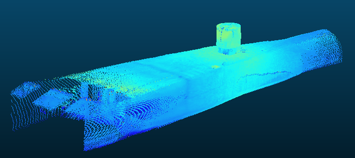
Processed Laser Point Cloud Data of an Outfall
Note the crushed corrugated pipe at the end
COMBINING INSPECTION SENSORS, CAN HELP TO REDUCE REPAIR COSTS AND MINIMIZE DOWNTIME BY IDENTIFYING ISSUES MORE ACCURATELY AND QUICKLY. MUNICIPALITIES CAN MAKE REPAIRS MORE EFFICIENTLY AND WITH LESS DISRUPTION TO THE SEWER SYSTEM.
Selected Sensors
- Time of flight 2d lasers.
- Time of flight 3d lasers.
- Digital profiling sonars.
- Digital 3D sonars.
- Digital scanning sonars.
- High resolution digital marine cameras.
- MH to MH gas and temperature sensors.
- RTK GPS for cm accuracy.
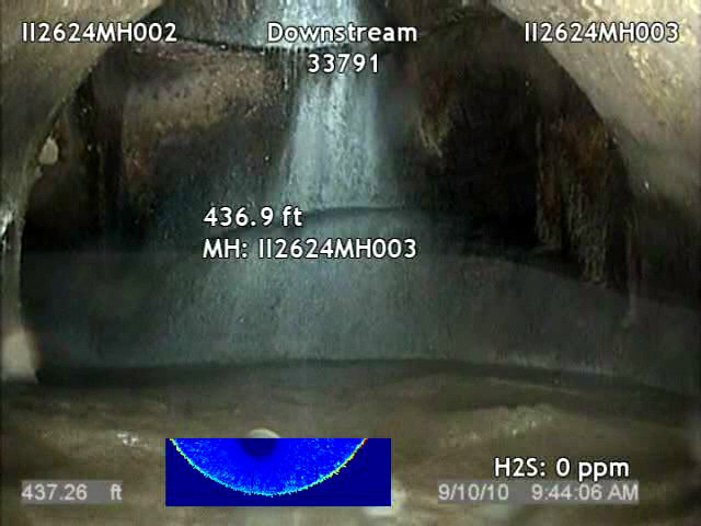
- H2S Sensor.
- Additional sensors are easily incorporated.
Available Equipment
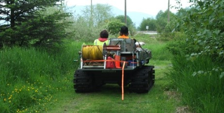
- 6 wheel drive amphibious ATV.
- 2,000ft. 4 wheel drive, skid steer tractor
- Pontoon floats.
- Electric winches with 1,200’ to 6,000’ of electro fiber,¼” steel cable.
- Digital Marine Cameras.
- Solid State Attitude Sensors.
- Hydraulic tow winch, 5,000” of rope.
- High capacity blower fan (1. 5 HP)
1080P Marine Video Cameras
- Max resolution: 1920 X 1080.
- Native MPEG 4 and Motion JPEG output.
- Natural Pan Tilt Camera Motion.
- 10 to 1 Zoom, 12 times digital.
- Clear jpg frame grabs.
- Wide dynamic range.
- Min Illumination 0.45 lux.
- High output LED lights.
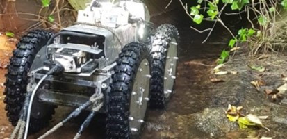
Ruggedized Tractors
Limitations:
- Soft sediment may prevent tractor travel.
- Pipe bends adding up to more than 90° may cause too much friction on the umbilical cable.
- High velocity flows may impact image as well as sonar and laser quality.
- Operating temperature range (-25° to 65° C).
Time of Flight Laser (ToF) Data
Time of Flight laser is a line of sight measuring instrument. This means that the units will collect accurate data in a changing pipe diameter. They will also collect manholes or pipe break measurements as they conduct a pipe survey.
In-house bench testing has shown an accuracy of 3mm-3/32″, with a 25m-82′. range
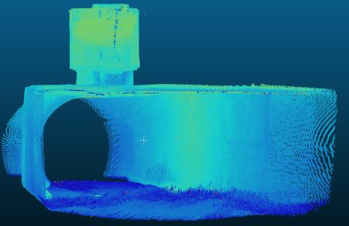
Siphon Gate Chamber
Benefits of Time of Flight laser:
Distance measurements are acquired by measuring the time it takes for the laser light to bounce off a target and return to its origin. Because light speed is constant, distance can be determined from the so-called “time of flight.” of the laser pulse. Measurements are made with respect to line-of-sight to the laser origin, so it allows for large changes in range such as traversing manholes. The unit reliably detects objects independent of the surface and ambient light. An accuracy of 8 mm is consistent no matter the range (from 5 cm to 25 m). The strength of the reflected light can be used to identify cracks, water infiltration and even spray-painted information in the pipe. (Light materials reflects more energy than dark material and a grey scale image can be produced)
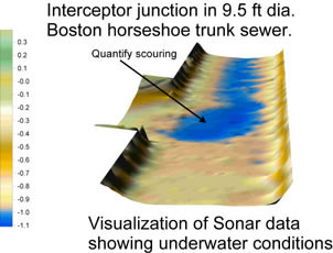
Pipe Profiling Sonar Data
Time of Flight Profiling Sonar is a line of sight measuring instrument. We utilize a high frequency profiling sonar head. Our minimum required standoff from the head is 3”, so we can collect sonar data in as little as 8” of standing water. We report the data in cross sections, longitudinal cross sections and sediment spreadsheets that can be easily interpreted.
In-house bench testing has shown an accuracy of 13mm-1.2″, with a 6m-19′ range
Laser and sonar can be used for pipe ovality measurements.
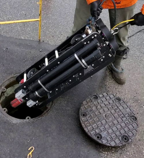
Manhole Scanning Unit
Two 12 mega pixel video cameras provide 360 degree view up and down. The Time of Flight laser collects laser point cloud data that is measurable and can be uploaded to CAD programs.
Quick Builds for Specific Projects
- On Staff, Software & Hardware Engineers.
- Quick solutions for emergency work.
- 30 yrs of experience in problem solving.
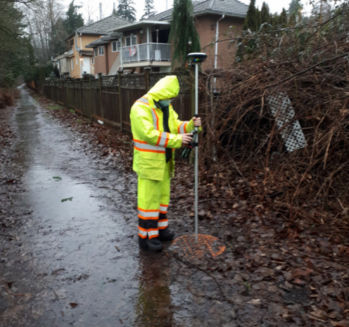
RTK GPS Units