Aquacoustic
+1.604.730.8117
+1.888.379.7601 (TollFree)
info@Aquacoustic.com
188 West 6th Avenue, Vancouver, BC V5Y 1K6
Search for:
Search Button
Home
Welcome
Our Services
Why Choose Us
Contact Form
About Us
Our Strengths
Our Values
Company Culture
Services
Dams & Reservoir Surveys
Dams Delivarables
Dam & Reservoir Technology
Stationary 3d Sonar Surveys
Benefits of 3d Surveys
Wastewater & Drainage
Undergound Pipe Mapping
Wastewater Deliverables
Wastewater & Drainage Technology
Large Diameter Pipe
River Crossing & Bridge Abutments
River Crossing Deliverables
Ports & Marina Surveys
Ports & Marina Deliverables
Mining Survey
Mine Surveys Deliverables
Borehole Deliverables
Borehole Surveys
Boreholes Deliverables
Boreholes Technology
Geomatics
Traffic Management
Contact Us
X
Book Consultation
Book Consultation
Borehole Deliverables
Collect angle of repose data from under pile docks
Borehole Surveys
We have developed a system capable of profiling through drilling mud.
Survey down 3,000’ (900 m) depth or more.
The system can be shipped by air cargo.
Request a Consultation
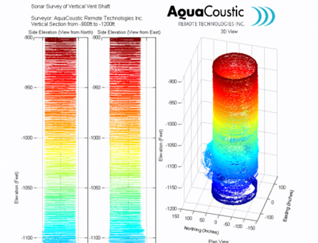
Bore hole deliverables
Hardware and software was developed in house
Produces an underwater 3D point cloud (XYZ data)
Approximately 2 cm accuracy
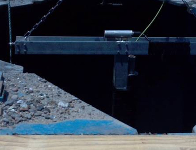
This image is part of the deliverables of a deep excavated bridge pile sonar survey, note the angled soft stratum.
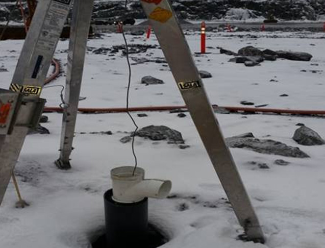
Mine stope 3D
An in house designed system that can be deployed through 6” boreholes
Depths of 1,000’ attainable
Better than 0.5" accuracy, depending on range
This image shows the top of a 6” borehole used to ensonify a flooded mine stope.
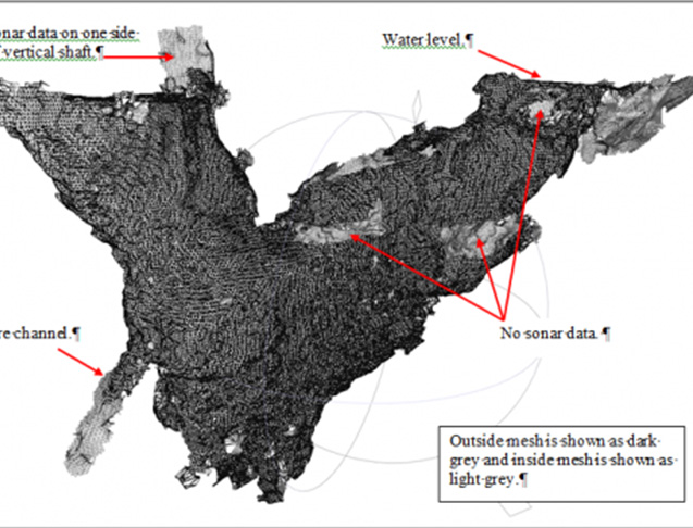
Mine survey deliverables
Survey 4 to 5 boreholes per day
Tie multiple surveys together
2,500’ system tether lengths available
Useful sonar range of 100 m
Sound footprint, approx. 3% of range
We use Total Stations and GPS units.
This image shows sonar XYZ data of a flooded 200 by 300 meter mine stope. Five different boreholes where used.
Request a Consultation