Aquacoustic

Shafts & Boreholes Delivarables

Collect bottom data under floating obstructions

Through drilling mud

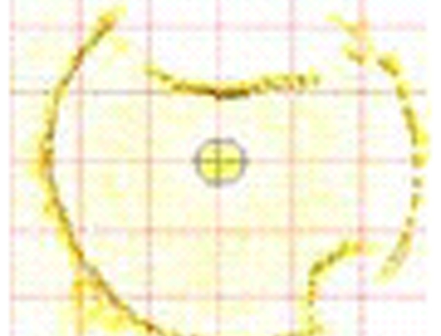
Actual sonar data showing a cross-sectional image of an excavated deep (1,400’) pile. The survey identified two large boulders that impeded the bucket.
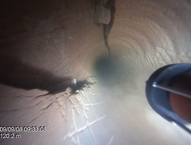
Video frame grab from a pre-grouting survey. The video shows a large crack in the sandstone rock. The sonar was then used to calculate the volume of grout needed.
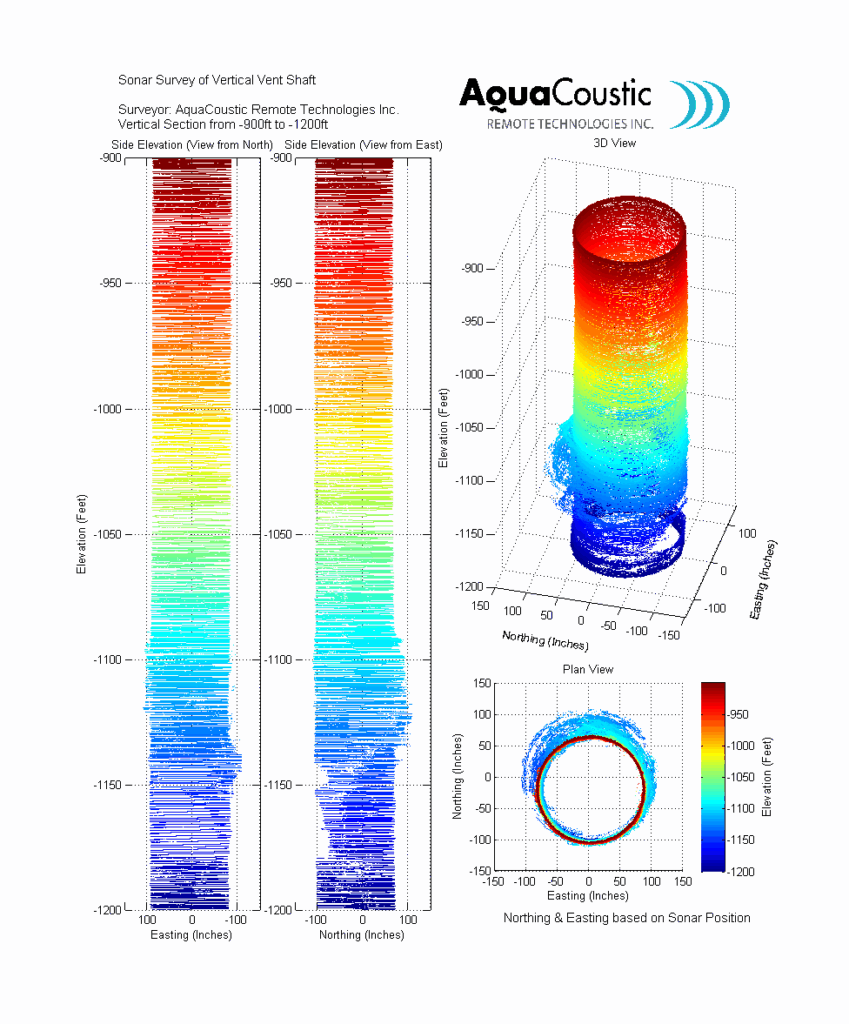
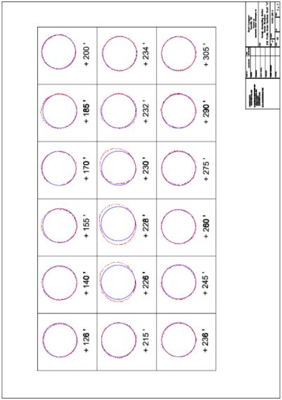
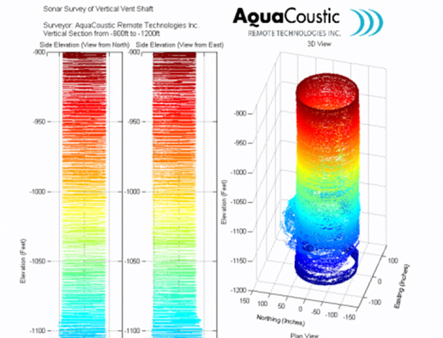
As part of a report the processed sonar images as well as sonar XYZ CAD ready data is included.
Sonar cross-sections are also included for further clarity.

Bore hole deliverables

This image is part of the deliverables of a borehole sonar survey, note the angled soft stratum.

Hardware and software was developed in house Produces an underwater 3D point cloud (XYZ data) Approximately 2 cm accuracy.