Underground Pipe Mapping
INTEGRATED SENSOR SURVEYS
With our Underground Pipe Mapping services we will provide you with XYZ data that you can use in your CAD program. Identify the exact placements of underground sewer lines. For pipe sizes down to 300mm/12in . 2CM forward accuracy, 10 mm cross-sectional accuracy
What we do:
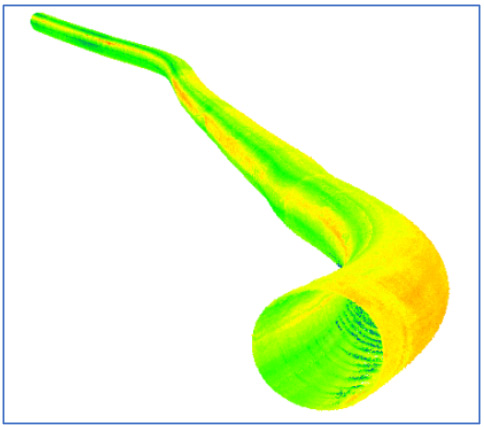
Our spatial mapping unit is used to collect underground pipe orientation in 3D. The report includes:
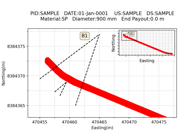
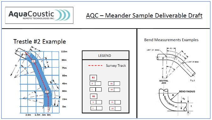
- Plan and elevation views.
- Bend radius.
- Meander point-cloud graph.
- CAD Ready data for modeling programs.
- RTK GPS table to map pipe center line to the surface.
- Ovality if required.
- Size and Shape Cross Sections.
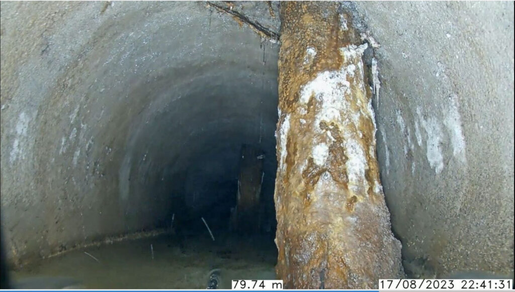
- A supplemental CCTV video file is supplied to provide visual reference of the pipe’s interior.
Benefits to You:
- Aids in urban planning and development.
- Allows for the effective placement of new infrastructure
- Avoid pipe damage and costly repairs
- Ensure non-interference with existing utilities.
- Ensure uninterrupted service to the community.
- Knowledge of underground assets helps optimize land use.
- Prevents conflicts during new construction projects.
- Ideal for pipe lining operations.
- Integration with remote sensing technologies and Geographic Information Systems (GIS) enhances the accuracy and accessibility of underground pipe mapping data.
The data can be used for computer modeling. The models simulate how the system will behave under different conditions such as:
- Heavy rainfalls
- Clogged pipes
- To identify potential problems
- Plan for future upgrades or expansions
- Calculate storage capacity to facilitate repairs
Manage sewer system assets including the location, condition, and lifespan of pipes and other infrastructure. The information is essential for planning maintenance and replacement of the sewer system components.